
Meissen topographic map
Click on the map to display elevation.
About this map
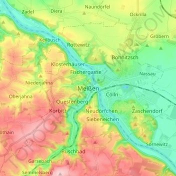
Name: Meissen topographic map, elevation, terrain.
Location: Meissen, Meißen, Saxony, 01662, Germany (51.12309 13.43049 51.20309 13.51049)
Average elevation: 162 m
Minimum elevation: 85 m
Maximum elevation: 265 m
Other topographic maps
Click on a map to view its topography, its elevation and its terrain.