
Northern Region topographic map
Interactive map
Click on the map to display elevation.
About this map
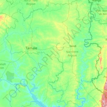
Name: Northern Region topographic map, elevation, terrain.
Location: Northern Region, Ghana (8.22848 -1.37363 10.35902 0.56700)
Average elevation: 149 m
Minimum elevation: 74 m
Maximum elevation: 853 m
Other topographic maps
Click on a map to view its topography, its elevation and its terrain.
La
Ghana > Greater Accra Region > La-Dade-Kotopon Municipal District > Accra > La
Average elevation: 16 m