
Thank you for supporting this site ❤️
Make a donation
Make a donation
Awiebo topographic map
Click on the map to display elevation.
Thank you for supporting this site ❤️
Make a donation
Make a donation
About this map
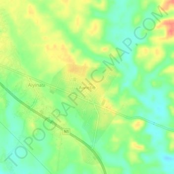
Name: Awiebo topographic map, elevation, terrain.
Location: Awiebo, Ellembelle District, Western Region, Ghana (5.02145 -2.47113 5.06145 -2.43113)
Average elevation: 31 m
Minimum elevation: 7 m
Maximum elevation: 62 m
Thank you for supporting this site ❤️
Make a donation
Make a donation