
前锋区 topographic map
Interactive map
Click on the map to display elevation.
About this map
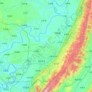
Name: 前锋区 topographic map, elevation, terrain.
Location: 前锋区, 广安市, 四川省, 中国 (30.42138 106.64091 30.65380 107.03740)
Average elevation: 437 m
Minimum elevation: 204 m
Maximum elevation: 1,325 m
Other topographic maps
Click on a map to view its topography, its elevation and its terrain.