
Thank you for supporting this site ❤️
Make a donation
Make a donation
Guilhim topographic map
Click on the map to display elevation.
Thank you for supporting this site ❤️
Make a donation
Make a donation
About this map
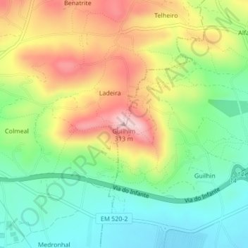
Name: Guilhim topographic map, elevation, terrain.
Location: Guilhim, Faro, 8005-517, Portugal (37.10108 -7.93310 37.10118 -7.93300)
Average elevation: 155 m
Minimum elevation: 51 m
Maximum elevation: 299 m
Thank you for supporting this site ❤️
Make a donation
Make a donation
Other topographic maps
Click on a map to view its topography, its elevation and its terrain.