
黄土坡村 topographic map
Interactive map
Click on the map to display elevation.
About this map
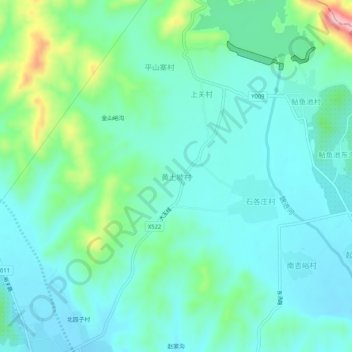
Name: 黄土坡村 topographic map, elevation, terrain.
Location: 黄土坡村, 唐山市, 河北省, 中国 (40.18988 117.69575 40.22988 117.73575)
Average elevation: 134 m
Minimum elevation: 90 m
Maximum elevation: 296 m
Other topographic maps
Click on a map to view its topography, its elevation and its terrain.