
杨柳庄镇 topographic map
Interactive map
Click on the map to display elevation.
About this map
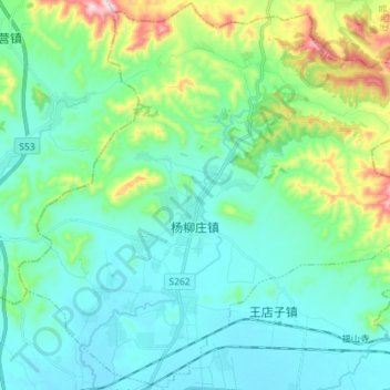
Name: 杨柳庄镇 topographic map, elevation, terrain.
Location: 杨柳庄镇, 滦州市, 唐山市, 河北省, 中国 (39.86547 118.31116 39.97367 118.45429)
Average elevation: 140 m
Minimum elevation: 43 m
Maximum elevation: 508 m
Other topographic maps
Click on a map to view its topography, its elevation and its terrain.