
Nauwalde topographic map
Interactive map
Click on the map to display elevation.
About this map
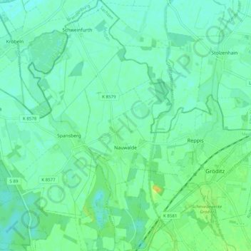
Name: Nauwalde topographic map, elevation, terrain.
Location: Nauwalde, Gröditz, Meißen, Sachsen, Deutschland (51.39250 13.33802 51.45421 13.43016)
Average elevation: 94 m
Minimum elevation: 87 m
Maximum elevation: 109 m
Other topographic maps
Click on a map to view its topography, its elevation and its terrain.
Schweinfurth
Deutschland > Sachsen > Meißen > Gröditz
Schweinfurth, Gröditz, Meißen, Sachsen, Deutschland
Average elevation: 92 m