
金竹山 topographic map
Interactive map
Click on the map to display elevation.
About this map
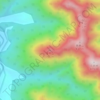
Name: 金竹山 topographic map, elevation, terrain.
Location: 金竹山, 宣城市, 安徽省, 中国 (30.56014 118.57153 30.56024 118.57163)
Average elevation: 420 m
Minimum elevation: 166 m
Maximum elevation: 826 m
Other topographic maps
Click on a map to view its topography, its elevation and its terrain.