
花垣县 topographic map
Interactive map
Click on the map to display elevation.
About this map
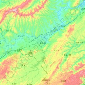
Name: 花垣县 topographic map, elevation, terrain.
Location: 花垣县, 湘西土家族苗族自治州, 湖南省, 中国 (28.41557 109.31698 28.73557 109.63698)
Average elevation: 541 m
Minimum elevation: 195 m
Maximum elevation: 1,270 m
Other topographic maps
Click on a map to view its topography, its elevation and its terrain.