
Jalandhar topographic map
Interactive map
Click on the map to display elevation.
About this map
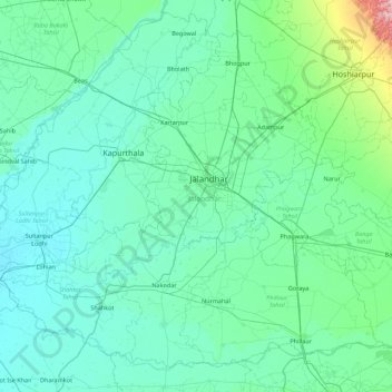
Name: Jalandhar topographic map, elevation, terrain.
Location: Jalandhar, Punjab, India (30.96813 75.07617 31.61717 75.95701)
Average elevation: 242 m
Minimum elevation: 211 m
Maximum elevation: 574 m
Other topographic maps
Click on a map to view its topography, its elevation and its terrain.