
地質溝洞 topographic map
Interactive map
Click on the map to display elevation.
About this map
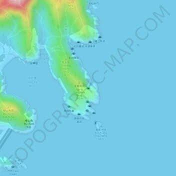
Name: 地質溝洞 topographic map, elevation, terrain.
Location: 地質溝洞, 麥理浩徑第2段, 西貢區, 新界, 香港, 中国 (22.36990 114.38954 22.37000 114.38964)
Average elevation: 20 m
Minimum elevation: -5 m
Maximum elevation: 240 m
Other topographic maps
Click on a map to view its topography, its elevation and its terrain.