
临渭区 topographic map
Interactive map
Click on the map to display elevation.
About this map
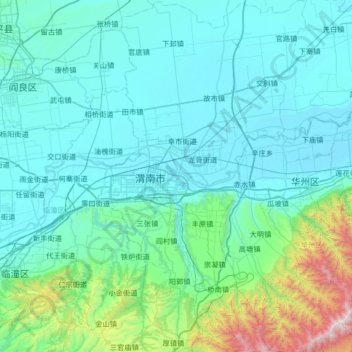
Name: 临渭区 topographic map, elevation, terrain.
Location: 临渭区, 渭南市, 陕西省, 中国 (34.24523 109.38595 34.79228 109.75853)
Average elevation: 594 m
Minimum elevation: 334 m
Maximum elevation: 2,615 m
Other topographic maps
Click on a map to view its topography, its elevation and its terrain.