Geolocate

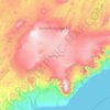
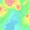
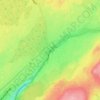
Akureyri topographic map

Click on the map to display elevation.

About this map
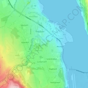
Name: Akureyri topographic map, elevation, terrain.

Location: Akureyri, Northeastern Region, Iceland (65.66045 -18.15952 65.70736 -18.06580)

Average elevation: 57 m

Minimum elevation: -4 m

Maximum elevation: 281 m

Other topographic maps

Click on a map to view its topography, its elevation and its terrain.
Reykjavik

Iceland

Average elevation: 67 m

Borgarnes

Iceland

Average elevation: 184 m

Syðstasúla

Iceland > Bláskógabyggð

Average elevation: 710 m

Westfjords Region

Iceland

Average elevation: 145 m

Mosfellsbær

Iceland

Average elevation: 122 m

Mosfellsbær

Iceland

Average elevation: 122 m

Keflavík

Iceland

Average elevation: 19 m

Ólafsvík

Iceland > Snæfellsbær

Average elevation: 123 m

Hella

Iceland > Rangárþing ytra

Average elevation: 34 m

Ísafjörður

Iceland > Ísafjarðarbær

Average elevation: 237 m

Seljanesfjall

Iceland > Árneshreppur

Average elevation: 133 m

Reykjavik

Iceland > Reykjavik

Average elevation: 89 m

Selfoss

Iceland > Sveitarfélagið Árborg

Average elevation: 48 m

Rangárþing ytra

Iceland

Average elevation: 401 m

Neskaupstaður

Iceland > Fjarðabyggð

Average elevation: 172 m

Rangárþing ytra

Iceland

Average elevation: 401 m

Hornstrandir

Iceland

Average elevation: 157 m

Súðavíkurhreppur

Iceland

Average elevation: 354 m

Húsavík

Iceland > Norðurþing

Average elevation: 107 m

Sauðárkrókur

Iceland > Skagafjörður

Average elevation: 128 m

Eyjafjörður

Iceland

Average elevation: 408 m

Reyðarfjörður

Iceland > Fjarðabyggð

Average elevation: 356 m

Þykkvibær

Iceland > Rangárþing ytra

Average elevation: 1 m

Reykjavik

Iceland

Average elevation: 67 m

Mælifell

Iceland > Rangárþing ytra

Average elevation: 576 m

Dalvík

Iceland > Dalvíkurbyggð

Average elevation: 182 m

Súðavíkurhreppur

Iceland

Average elevation: 354 m

Reynisfjara Beach

Iceland > Mýrdalshreppur

Average elevation: 23 m

Garður

Iceland

Average elevation: 6 m

Fjarðabyggð

Iceland

Average elevation: 350 m

Grindavík

Iceland > Grindavíkurbær

Average elevation: 27 m

Reykjavik

Iceland

Average elevation: 67 m

Vatnajökull

Iceland

Average elevation: 786 m

Sólheimajökull

Iceland > Mýrdalshreppur

Average elevation: 689 m

Elliðaey

Iceland > Vestmannaeyjabær

Average elevation: 2 m

Bláskógabyggð

Iceland

Average elevation: 511 m

Hafnarfjordur

Iceland

Average elevation: 162 m

Thingvellir

Iceland > Bláskógabyggð

Average elevation: 121 m

Grímsnes- og Grafningshreppur

Iceland

Average elevation: 341 m

Seydisfjordur

Iceland > Múlaþing

A road over Fjarðarheiði mountain pass (elevation 600 m or 2,000 ft) connects Seyðisfjörður to the rest of Iceland; 27 kilometres (17 miles) to the Ring Road and Egilsstaðir. Seyðisfjörður is surrounded by mountains with the most prominent Mt. Bjólfur to the west (1085 m) and Strandartindur (1010 m)…
Average elevation: 443 m

Fjallabyggð

Iceland

Average elevation: 305 m

Kirkjufell

Iceland > Grundarfjarðarbær

Average elevation: 34 m

Langjökull

Iceland

Average elevation: 864 m

Westfjords Region

Iceland

Average elevation: 145 m

Kopavogur

Iceland

Average elevation: 248 m

Mývatn

Iceland > Þingeyjarsveit > Reykjahlíð

Average elevation: 285 m

Vik

Iceland > Mýrdalshreppur

Vík í Mýrdal is the warmest place in Iceland, with an annual mean temperature of 5.3 °C (41.5 °F). Like most of coastal Iceland, Vík í Mýrdal has a subpolar oceanic climate (Koppen Cfc) with cold but not severe winters and cool, short summers. Its winters are among the warmest in Iceland, with an…

Average elevation: 106 m
Vatnajökull

Iceland

Average elevation: 786 m

Húsavík

Iceland > Norðurþing

Average elevation: 107 m

Kirkjufell

Iceland > Grundarfjarðarbær

Average elevation: 34 m

Dettifoss

Iceland > Norðurþing

Average elevation: 341 m

Godafoss Waterfall

Iceland > Þingeyjarsveit

Average elevation: 127 m

Western Region

Iceland

Average elevation: 235 m

Grindavík

Iceland > Grindavíkurbær

Average elevation: 27 m

Laki

Iceland > Skaftárhreppur

The eruption, also known as the Skaftáreldar [ˈskaftˌauːrˌɛltar̥] ("Skaftá fires") or Síðueldur [ˈsiːðʏˌɛltʏr̥] produced an estimated 14 km3 (18×10^9 cu yd) of basalt lava, and the total volume of tephra emitted was 0.91 km3 (1.2×10^9 cu yd). Lava fountains were estimated to have reached…

Average elevation: 626 m

Hverfjall

Iceland > Þingeyjarsveit

Average elevation: 330 m

Sveitarfélagið Ölfus

Iceland

Average elevation: 158 m

Gullfoss Falls

Iceland > Bláskógabyggð

Average elevation: 221 m

Eldfell

Iceland > Vestmannaeyjar

Average elevation: 45 m

Vatnajökull

Iceland

Average elevation: 786 m

Sveitarfélagið Vogar

Iceland

Average elevation: 40 m

Eyjafjallajökull

Iceland > Rangárþing eystra

Eyjafjallajökull (Icelandic: (listen); lit. 'glacier of the mountains of the islands') is one of the smaller ice caps of Iceland, north of Skógar and west of Mýrdalsjökull. The ice cap covers the caldera of a volcano with a summit elevation of 1,651 metres (5,417 ft). The volcano has erupted relatively…

Average elevation: 819 m

Skogafoss

Iceland > Rangárþing eystra

Average elevation: 145 m

Langjökull

Iceland

Average elevation: 864 m

Vestmannaeyjabær

Iceland

Average elevation: 2 m

Askja

Iceland > Þingeyjarsveit

Average elevation: 1,062 m

Eruption by Fagradalsfjall

Iceland

Average elevation: 253 m

Múlaþing

Iceland

Average elevation: 636 m

Grundarfjörður

Iceland > Grundarfjarðarbær

Average elevation: 181 m

Reykjanesskagi

Iceland

Average elevation: 51 m

Reykjavik

Iceland

Average elevation: 67 m

Grímsnes- og Grafningshreppur

Iceland

Average elevation: 341 m

Capital Region

Iceland

Average elevation: 176 m

Selfoss

Iceland > Sveitarfélagið Árborg

Average elevation: 48 m

Borgarbyggð

Iceland

Average elevation: 333 m

Grímsey

Iceland > Akureyrarbær

There are steep cliffs all along the coastline except on the southwestern shore. Grímsey has an area of 5.3 square kilometres (2.0 sq mi), and a maximum elevation of 105 metres (344 ft).

Average elevation: 12 m

Kerlingarfjöll

Iceland > Rangárþing ytra

Average elevation: 612 m

Hekla

Iceland > Rangárþing ytra

Before the eruption, a greater than normal amount of snow melting had occurred, indicating the volcano was heating up. Earth tremors began at 8:48 pm on the evening of the eruption; the largest had a magnitude of 4. The eruption started weakly at 9:23 pm IMT ± 2 min before increasing in power. The first…

Average elevation: 1,134 m

Dalvík

Iceland > Dalvíkurbyggð

Average elevation: 182 m

Skogafoss

Iceland > Rangárþing eystra

Average elevation: 145 m

Geysir

Iceland > Bláskógabyggð

Average elevation: 116 m

Flateyri

Iceland > Ísafjarðarbær

Average elevation: 90 m

Mælifell

Iceland > Vopnafjarðarhreppur

Average elevation: 546 m

Vatnajökull

Iceland

Average elevation: 786 m

Grundarfjarðarbær

Iceland

Average elevation: 184 m

Vik

Iceland > Mýrdalshreppur

Vík í Mýrdal is the warmest place in Iceland, with an annual mean temperature of 5.3 °C (41.5 °F). Like most of coastal Iceland, Vík í Mýrdal has a subpolar oceanic climate (Koppen Cfc) with cold but not severe winters, and cool, short summers. Its winters are among the warmest in Iceland, with an…

Average elevation: 106 m

Fagradalsfjall

Iceland > Grindavíkurbær

Average elevation: 163 m

Snæfellsjökull

Iceland

Average elevation: 962 m