
Pella topographic map
Click on the map to display elevation.
About this map
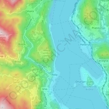
Name: Pella topographic map, elevation, terrain.
Location: Pella, Novara, Piedmont, Italy (45.78401 8.36717 45.84014 8.40839)
Average elevation: 475 m
Minimum elevation: 277 m
Maximum elevation: 1,110 m
Other topographic maps
Click on a map to view its topography, its elevation and its terrain.