
代县 topographic map
Interactive map
Click on the map to display elevation.
About this map
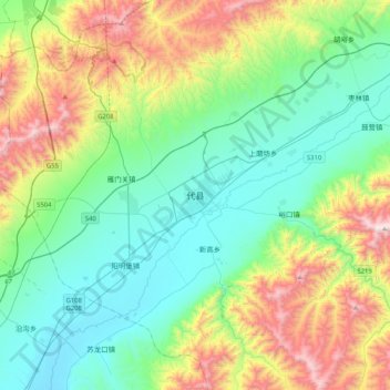
Name: 代县 topographic map, elevation, terrain.
Location: 代县, 忻州市, 山西省, 中国 (38.90998 112.78629 39.22998 113.10629)
Average elevation: 1,202 m
Minimum elevation: 819 m
Maximum elevation: 2,160 m
Other topographic maps
Click on a map to view its topography, its elevation and its terrain.