
Thank you for supporting this site ❤️
Make a donation
Make a donation
Caldeireiros topographic map
Click on the map to display elevation.
Thank you for supporting this site ❤️
Make a donation
Make a donation
About this map
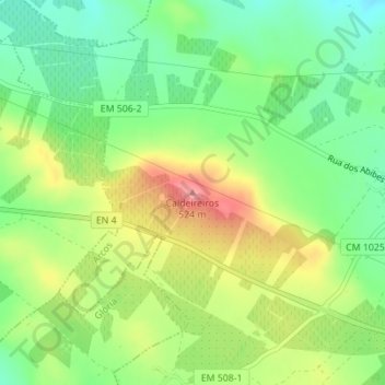
Name: Caldeireiros topographic map, elevation, terrain.
Location: Caldeireiros, Estremoz, Évora, 7100-032, Portugal (38.83439 -7.53454 38.83449 -7.53444)
Average elevation: 458 m
Minimum elevation: 414 m
Maximum elevation: 517 m
Thank you for supporting this site ❤️
Make a donation
Make a donation
Other topographic maps
Click on a map to view its topography, its elevation and its terrain.