
Oskaloosa topographic map
Interactive map
Click on the map to display elevation.
About this map
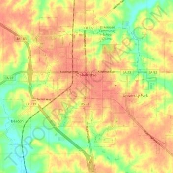
Name: Oskaloosa topographic map, elevation, terrain.
Location: Oskaloosa, Mahaska County, Iowa, United States (41.26002 -92.67908 41.32061 -92.58755)
Average elevation: 244 m
Minimum elevation: 213 m
Maximum elevation: 262 m
Other topographic maps
Click on a map to view its topography, its elevation and its terrain.
Leighton
United States > Iowa > Mahaska County
Leighton, Mahaska County, Iowa, United States
Average elevation: 247 m
Rose Hill
United States > Iowa > Mahaska County > Rose Hill
Rose Hill, Mahaska County, Iowa, United States
Average elevation: 238 m