
Valverde de Ágreda topographic map
Interactive map
Click on the map to display elevation.
About this map
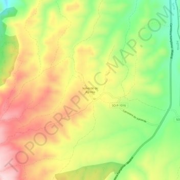
Name: Valverde de Ágreda topographic map, elevation, terrain.
Location: Valverde de Ágreda, Ágreda, Soria, Castilla y León, España (41.89299 -1.90415 41.93299 -1.86415)
Average elevation: 801 m
Minimum elevation: 646 m
Maximum elevation: 949 m
Other topographic maps
Click on a map to view its topography, its elevation and its terrain.
Moncayo
España > Castilla y León > Ágreda
Moncayo, Ágreda, Soria, Castilla y León, España
Average elevation: 1,954 m