
Thank you for supporting this site ❤️
Make a donation
Make a donation
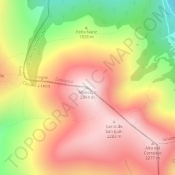
Moncayo topographic map
Click on the map to display elevation.
Thank you for supporting this site ❤️
Make a donation
Make a donation
Moncayo
Otros estudios sobre distribución de las precipitaciones concluyen que se reparten con la altitud, con la isoyeta de más de 1400 mm por encima de los 2000 m s. n. m. y a partir de aquí una reducción de las precipitaciones de 119,89 mm por cada 100 metros de descenso
Thank you for supporting this site ❤️
Make a donation
Make a donation
About this map
Name: Moncayo topographic map, elevation, terrain.
Location: Moncayo, Ágreda, Soria, Castilla y León, España (41.78711 -1.83976 41.78721 -1.83966)
Average elevation: 1,954 m
Minimum elevation: 1,466 m
Maximum elevation: 2,313 m
Thank you for supporting this site ❤️
Make a donation
Make a donation