
梅溪镇 topographic map
Interactive map
Click on the map to display elevation.
About this map
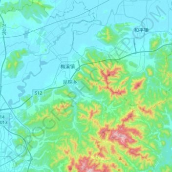
Name: 梅溪镇 topographic map, elevation, terrain.
Location: 梅溪镇, 安吉县, 湖州市, 浙江省, 中国 (30.64136 119.68993 30.86896 119.88466)
Average elevation: 102 m
Minimum elevation: -2 m
Maximum elevation: 654 m
Other topographic maps
Click on a map to view its topography, its elevation and its terrain.