
玉龙街道办 topographic map
Interactive map
Click on the map to display elevation.
About this map
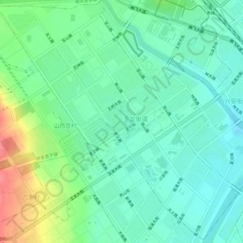
Name: 玉龙街道办 topographic map, elevation, terrain.
Location: 玉龙街道办, 松山区, 赤峰市, 内蒙古自治区, 中国 (42.24050 118.85461 42.27423 118.90143)
Average elevation: 591 m
Minimum elevation: 571 m
Maximum elevation: 638 m
Other topographic maps
Click on a map to view its topography, its elevation and its terrain.