
Thank you for supporting this site ❤️
Make a donation
Make a donation
Songming County topographic map
Click on the map to display elevation.
Thank you for supporting this site ❤️
Make a donation
Make a donation
About this map
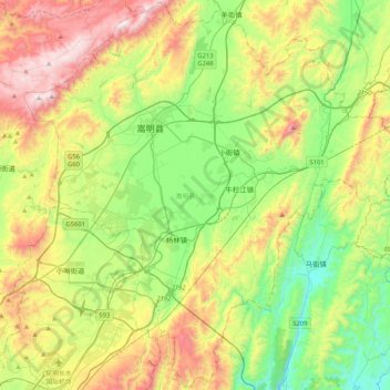
Name: Songming County topographic map, elevation, terrain.
Location: Songming County, Kunming, Yunnan, China (25.08228 102.90193 25.45478 103.31782)
Average elevation: 2,067 m
Minimum elevation: 1,632 m
Maximum elevation: 2,807 m
Thank you for supporting this site ❤️
Make a donation
Make a donation
Other topographic maps
Click on a map to view its topography, its elevation and its terrain.
Thank you for supporting this site ❤️
Make a donation
Make a donation