
Thank you for supporting this site ❤️
Make a donation
Make a donation
Malang topographic map
Click on the map to display elevation.
Thank you for supporting this site ❤️
Make a donation
Make a donation
About this map
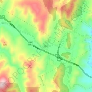
Name: Malang topographic map, elevation, terrain.
Location: Malang, Kunming, Yunnan, China (24.88018 102.91622 24.92018 102.95622)
Average elevation: 2,100 m
Minimum elevation: 1,930 m
Maximum elevation: 2,311 m
Thank you for supporting this site ❤️
Make a donation
Make a donation
Other topographic maps
Click on a map to view its topography, its elevation and its terrain.