
下大武乡 topographic map
Interactive map
Click on the map to display elevation.
About this map
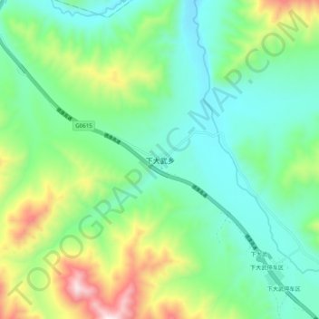
Name: 下大武乡 topographic map, elevation, terrain.
Location: 下大武乡, 玛沁县, 果洛藏族自治州, 青海省, 中国 (34.96381 99.22052 35.04381 99.30052)
Average elevation: 4,133 m
Minimum elevation: 3,882 m
Maximum elevation: 4,767 m
Other topographic maps
Click on a map to view its topography, its elevation and its terrain.