
Hammam Lif topographic map
Interactive map
Click on the map to display elevation.
About this map
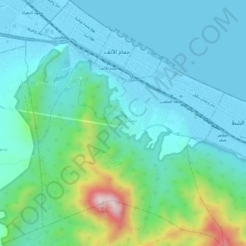
Name: Hammam Lif topographic map, elevation, terrain.
Location: Hammam Lif, Ben Arous, 2093, Tunisie (36.69721 10.31627 36.74034 10.35989)
Average elevation: 106 m
Minimum elevation: -2 m
Maximum elevation: 550 m
Other topographic maps
Click on a map to view its topography, its elevation and its terrain.