
Kampong Speu topographic map
Interactive map
Click on the map to display elevation.
Kampong Speu
Phnom Aural is the tallest peak in Cambodia. It is 1,813 meters tall (other sources give elevations between 1,771 and 1,667 meters). It is in the eastern part of the Cardamom Mountains. To protect the biodiversity of the mountains, Phnom Aural Wildlife Sanctuary was established. This mountain located in Aoral District, Kampong Speu province.
About this map
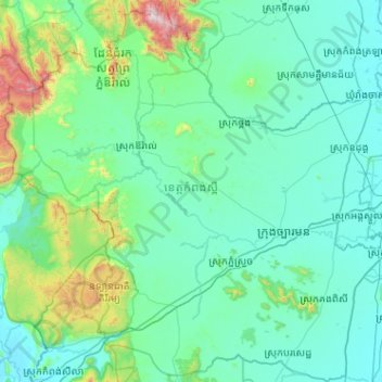
Name: Kampong Speu topographic map, elevation, terrain.
Location: Kampong Speu, Cambodia (11.07792 103.77298 12.07685 104.79258)
Average elevation: 180 m
Minimum elevation: -1 m
Maximum elevation: 1,789 m
Other topographic maps
Click on a map to view its topography, its elevation and its terrain.