
叠溪镇 topographic map
Interactive map
Click on the map to display elevation.
About this map
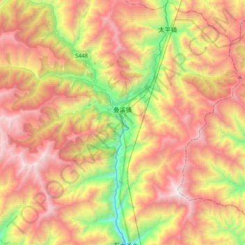
Name: 叠溪镇 topographic map, elevation, terrain.
Location: 叠溪镇, 茂县, 阿坝藏族羌族自治州, 四川省, 中国 (31.94022 103.45695 32.11772 103.75584)
Average elevation: 3,260 m
Minimum elevation: 1,775 m
Maximum elevation: 4,731 m
Other topographic maps
Click on a map to view its topography, its elevation and its terrain.