
Penama topographic map
Interactive map
Click on the map to display elevation.
About this map
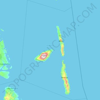
Name: Penama topographic map, elevation, terrain.
Location: Penama, Vanuatu (-16.09500 167.43000 -14.47500 168.55148)
Average elevation: 18 m
Minimum elevation: 0 m
Maximum elevation: 1,465 m
Other topographic maps
Click on a map to view its topography, its elevation and its terrain.