
爱民区 topographic map
Interactive map
Click on the map to display elevation.
About this map
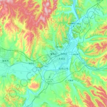
Name: 爱民区 topographic map, elevation, terrain.
Location: 爱民区, 牡丹江市, 黑龙江省, 157000, 中国 (44.43409 129.42448 44.75409 129.74448)
Average elevation: 354 m
Minimum elevation: 217 m
Maximum elevation: 691 m
Other topographic maps
Click on a map to view its topography, its elevation and its terrain.