
黄渡乡 topographic map
Interactive map
Click on the map to display elevation.
About this map
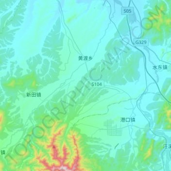
Name: 黄渡乡 topographic map, elevation, terrain.
Location: 黄渡乡, 宣州区, 宣城市, 安徽省, 中国 (30.65345 118.79218 30.87575 118.95298)
Average elevation: 114 m
Minimum elevation: 16 m
Maximum elevation: 942 m
Other topographic maps
Click on a map to view its topography, its elevation and its terrain.