
九華徑 topographic map
Interactive map
Click on the map to display elevation.
About this map
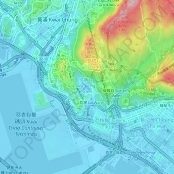
Name: 九華徑 topographic map, elevation, terrain.
Location: 九華徑, 葵青區, 新界, 香港, 中国 (22.32531 114.11643 22.36531 114.15643)
Average elevation: 65 m
Minimum elevation: -12 m
Maximum elevation: 344 m
Other topographic maps
Click on a map to view its topography, its elevation and its terrain.