
光輝圍 topographic map
Interactive map
Click on the map to display elevation.
About this map
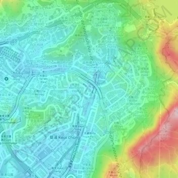
Name: 光輝圍 topographic map, elevation, terrain.
Location: 光輝圍, 橫龍仔, 中葵涌, 葵涌, 葵青區, 新界, 香港, 中国 (22.35818 114.12301 22.37818 114.14301)
Average elevation: 95 m
Minimum elevation: 2 m
Maximum elevation: 338 m
Other topographic maps
Click on a map to view its topography, its elevation and its terrain.