
陡山乡 topographic map
Interactive map
Click on the map to display elevation.
About this map
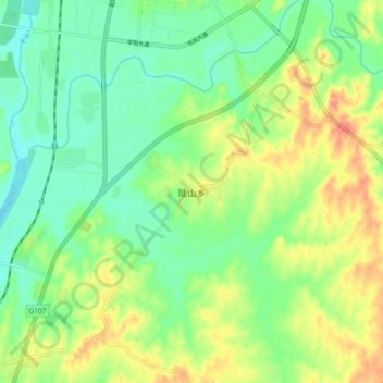
Name: 陡山乡 topographic map, elevation, terrain.
Location: 陡山乡, 孝昌县, 孝感市, 湖北省, 中国 (31.16247 113.96305 31.24247 114.04305)
Average elevation: 47 m
Minimum elevation: 26 m
Maximum elevation: 76 m
Other topographic maps
Click on a map to view its topography, its elevation and its terrain.