
孝昌县 topographic map
Interactive map
Click on the map to display elevation.
About this map
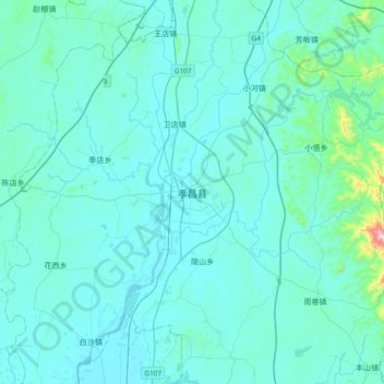
Name: 孝昌县 topographic map, elevation, terrain.
Location: 孝昌县, 孝感市, 湖北省, 中国 (31.09940 113.83300 31.41940 114.15300)
Average elevation: 76 m
Minimum elevation: 22 m
Maximum elevation: 782 m
Other topographic maps
Click on a map to view its topography, its elevation and its terrain.