
Thank you for supporting this site ❤️
Make a donation
Make a donation
Kennedyville topographic map
Click on the map to display elevation.
Thank you for supporting this site ❤️
Make a donation
Make a donation
About this map
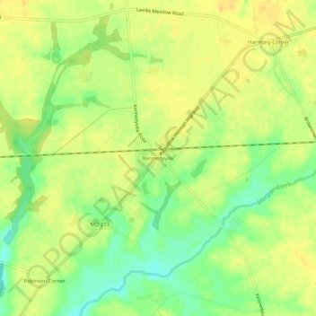
Name: Kennedyville topographic map, elevation, terrain.
Location: Kennedyville, Kent County, Maryland, 21645, United States (39.28539 -76.01494 39.32539 -75.97494)
Average elevation: 18 m
Minimum elevation: 1 m
Maximum elevation: 27 m
Thank you for supporting this site ❤️
Make a donation
Make a donation
Other topographic maps
Click on a map to view its topography, its elevation and its terrain.