
Thank you for supporting this site ❤️
Make a donation
Make a donation
Lily Lake topographic map
Click on the map to display elevation.
Thank you for supporting this site ❤️
Make a donation
Make a donation
About this map
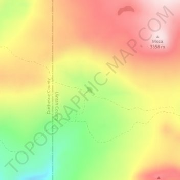
Name: Lily Lake topographic map, elevation, terrain.
Location: Lily Lake, Uintah County, Utah, United States (40.68258 -109.96973 40.68355 -109.96860)
Average elevation: 3,194 m
Minimum elevation: 2,989 m
Maximum elevation: 3,359 m
Thank you for supporting this site ❤️
Make a donation
Make a donation
Other topographic maps
Click on a map to view its topography, its elevation and its terrain.