
Thank you for supporting this site ❤️
Make a donation
Make a donation
Taboada topographic map
Click on the map to display elevation.
Thank you for supporting this site ❤️
Make a donation
Make a donation
About this map
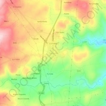
Name: Taboada topographic map, elevation, terrain.
Location: Taboada, Chantada, Lugo, Galicia, 27550, España (42.69567 -7.78298 42.73567 -7.74298)
Average elevation: 530 m
Minimum elevation: 404 m
Maximum elevation: 654 m
Thank you for supporting this site ❤️
Make a donation
Make a donation
Other topographic maps
Click on a map to view its topography, its elevation and its terrain.
Thank you for supporting this site ❤️
Make a donation
Make a donation
Thank you for supporting this site ❤️
Make a donation
Make a donation
Thank you for supporting this site ❤️
Make a donation
Make a donation
Thank you for supporting this site ❤️
Make a donation
Make a donation