
Thank you for supporting this site ❤️
Make a donation
Make a donation
Chantada topographic map
Click on the map to display elevation.
Thank you for supporting this site ❤️
Make a donation
Make a donation
About this map
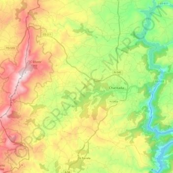
Name: Chantada topographic map, elevation, terrain.
Location: Chantada, Lugo, Galicia, Spain (42.53195 -7.91571 42.68957 -7.68272)
Average elevation: 564 m
Minimum elevation: 204 m
Maximum elevation: 1,072 m
Thank you for supporting this site ❤️
Make a donation
Make a donation