
Watkins Glen topographic map
Interactive map
Click on the map to display elevation.
About this map
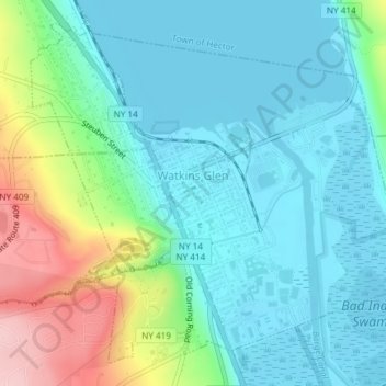
Name: Watkins Glen topographic map, elevation, terrain.
Location: Watkins Glen, Schuyler County, New York, United States (42.36813 -76.88575 42.39056 -76.84911)
Average elevation: 179 m
Minimum elevation: 133 m
Maximum elevation: 318 m