
Olmito topographic map
Click on the map to display elevation.
About this map
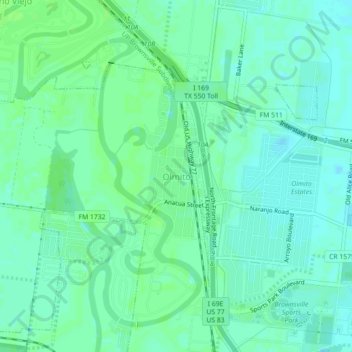
Name: Olmito topographic map, elevation, terrain.
Location: Olmito, Cameron County, Texas, 78575, United States (25.99944 -97.55471 26.03944 -97.51471)
Average elevation: 11 m
Minimum elevation: 6 m
Maximum elevation: 14 m
Other topographic maps
Click on a map to view its topography, its elevation and its terrain.
Brownsville
United States > Texas > Cameron County
Soils are mostly of clay to silty clay loam texture, moderately alkaline (pH 8.2) to strongly alkaline (pH 8.5 and with a significant degree of salinity in many places; other types of soils present around the city include Cameron clay and sporadic amounts of Laredo silt loam. Due to Brownsville's proximity to…
Average elevation: 9 m
Starbase
United States > Texas > Cameron County
SpaceX conducted a groundbreaking ceremony on the new launch facility in September 2014, and soil preparation began in October 2015. The first tracking antenna was installed in August 2016, and the first propellant tank arrived in July 2018. In late 2018, construction ramped up considerably, and the site saw…
Average elevation: 2 m
Brownsville
United States > Texas > Cameron County
Soils are mostly of clay to silty clay loam texture, moderately alkaline (pH 8.2) to strongly alkaline (pH 8.5 and with a significant degree of salinity in many places; other types of soils present around the city include Cameron clay and sporadic amounts of Laredo silt loam. Due to Brownsville's proximity to…
Average elevation: 9 m
Brownsville
United States > Texas > Cameron County
Soils are mostly of clay to silty clay loam texture, moderately alkaline (pH 8.2) to strongly alkaline (pH 8.5) and with a significant degree of salinity in many places; other types of soils present around the city include Cameron clay and sporadic amounts of Laredo silt loam. Due to Brownsville's proximity to…
Average elevation: 9 m
Starbase
United States > Texas > Cameron County
SpaceX conducted a groundbreaking ceremony on the new launch facility in September 2014, and soil preparation began in October 2015. The first tracking antenna was installed in August 2016, and the first propellant tank arrived in July 2018. In late 2018, construction ramped up considerably, and the site saw…
Average elevation: 2 m
Brownsville
United States > Texas > Cameron County
Soils are mostly of clay to silty clay loam texture, moderately alkaline (pH 8.2) to strongly alkaline (pH 8.5) and with a significant degree of salinity in many places; other types of soils present around the city include Cameron clay and sporadic amounts of Laredo silt loam. Due to Brownsville's proximity to…
Average elevation: 9 m