
Huandoy topographic map
Interactive map
Click on the map to display elevation.
About this map
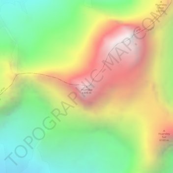
Name: Huandoy topographic map, elevation, terrain.
Location: Huandoy, Yungay, Áncash, Perú (-9.03492 -77.66987 -9.03482 -77.66977)
Average elevation: 5,542 m
Minimum elevation: 4,783 m
Maximum elevation: 6,371 m
Other topographic maps
Click on a map to view its topography, its elevation and its terrain.
Laguna de Llanganuco Chinancocha
Laguna de Llanganuco Chinancocha, Yungay, Áncash, Perú
Average elevation: 4,213 m