
Njutånger topographic map
Interactive map
Click on the map to display elevation.
About this map
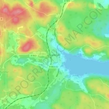
Name: Njutånger topographic map, elevation, terrain.
Average elevation: 37 m
Minimum elevation: -1 m
Maximum elevation: 96 m
Other topographic maps
Click on a map to view its topography, its elevation and its terrain.
Söderhamn
Söderhamn, Söderhamns kommun, Gävleborg County, 826 30, Sweden
Average elevation: 24 m