
Amfreville-la-Campagne topographic map
Interactive map
Click on the map to display elevation.
About this map
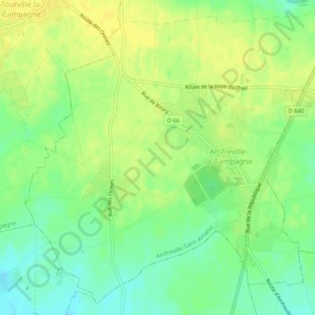
Name: Amfreville-la-Campagne topographic map, elevation, terrain.
Average elevation: 159 m
Minimum elevation: 146 m
Maximum elevation: 168 m
Other topographic maps
Click on a map to view its topography, its elevation and its terrain.
Saint-Amand-des-Hautes-Terres
France > Normandie > Eure > Amfreville-Saint-Amand
Saint-Amand-des-Hautes-Terres, Amfreville-Saint-Amand, Bernay, Eure, Normandie, France métropolitaine, 27370, France
Average elevation: 154 m