
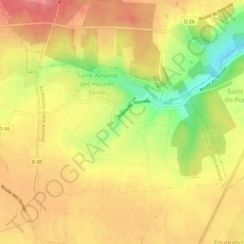
Saint-Amand-des-Hautes-Terres topographic map
Interactive map
Click on the map to display elevation.
About this map
Name: Saint-Amand-des-Hautes-Terres topographic map, elevation, terrain.
Average elevation: 154 m
Minimum elevation: 105 m
Maximum elevation: 184 m
Les Hautes-Terres, dénomination ancienne comprenant une partie de la paroisse de Saint-Amand-des-Hautes-Terres et une assez grande étendue du territoire de Saint-Pierre-du-Bosguerard[3]. La commune est située à une altitude moyenne de 120m.
Other topographic maps
Click on a map to view its topography, its elevation and its terrain.
Amfreville-la-Campagne
France > Normandie > Eure > Amfreville-Saint-Amand
Amfreville-la-Campagne, Amfreville-Saint-Amand, Bernay, Eure, Normandie, France métropolitaine, 27370, France
Average elevation: 159 m