
Thank you for supporting this site ❤️
Make a donation
Make a donation
Lennox Island topographic map
Click on the map to display elevation.
Thank you for supporting this site ❤️
Make a donation
Make a donation
About this map
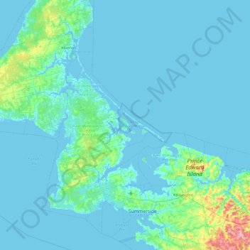
Name: Lennox Island topographic map, elevation, terrain.
Location: Lennox Island, Lennox Island 1, Prince Edward Island, Canada (46.29340 -64.17416 46.93340 -63.53416)
Average elevation: 10 m
Minimum elevation: -3 m
Maximum elevation: 141 m
Thank you for supporting this site ❤️
Make a donation
Make a donation