
Ashanti Region topographic map
Interactive map
Click on the map to display elevation.
About this map
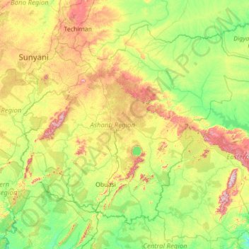
Name: Ashanti Region topographic map, elevation, terrain.
Location: Ashanti Region, Ghana (5.85482 -2.45159 7.62270 -0.23761)
Average elevation: 208 m
Minimum elevation: 33 m
Maximum elevation: 819 m
Other topographic maps
Click on a map to view its topography, its elevation and its terrain.
La
Ghana > Greater Accra Region > La-Dade-Kotopon Municipal District > Accra > La
Average elevation: 16 m