
大甲乡 topographic map
Interactive map
Click on the map to display elevation.
About this map
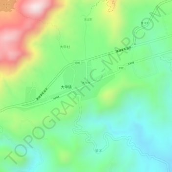
Name: 大甲乡 topographic map, elevation, terrain.
Location: 大甲乡, 大甲镇, 古田县, 宁德市, 福建省, 中国 (26.63516 119.26628 26.64318 119.28405)
Average elevation: 669 m
Minimum elevation: 505 m
Maximum elevation: 948 m
Other topographic maps
Click on a map to view its topography, its elevation and its terrain.