
Allendale Park topographic map
Interactive map
Click on the map to display elevation.
About this map
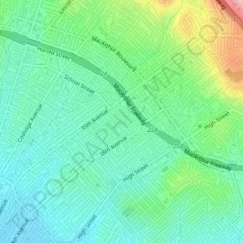
Name: Allendale Park topographic map, elevation, terrain.
Average elevation: 59 m
Minimum elevation: 12 m
Maximum elevation: 185 m
Other topographic maps
Click on a map to view its topography, its elevation and its terrain.
Claremont Canyon
United States > California > Alameda County > Oakland
Claremont Canyon, Upper Jordan Fire Trail, Oakland, Alameda County, California, 94720, United States
Average elevation: 367 m
Reinhardt-Redwood Regional Park
United States > California > Alameda County > Oakland
Reinhardt-Redwood Regional Park, Serpentine Prairie Trail, Oakland Hills, Oakland, Alameda County, CAL Fire Northern Region, California, 94615, United States
Average elevation: 292 m
Dunsmuir Reservoir 31-018 Dam
United States > California > Alameda County > Oakland
Dunsmuir Reservoir 31-018 Dam, Oakland, Alameda County, California, 94577, United States
Average elevation: 80 m