
Thank you for supporting this site ❤️
Make a donation
Make a donation
Claremont Canyon topographic map
Click on the map to display elevation.
Thank you for supporting this site ❤️
Make a donation
Make a donation
About this map
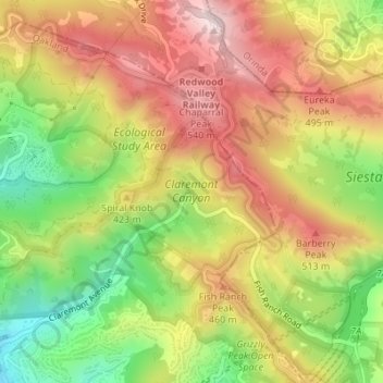
Name: Claremont Canyon topographic map, elevation, terrain.
Average elevation: 367 m
Minimum elevation: 137 m
Maximum elevation: 570 m
Thank you for supporting this site ❤️
Make a donation
Make a donation
Other topographic maps
Click on a map to view its topography, its elevation and its terrain.
Oakland Casting Club pools
United States > California > Alameda County > Oakland
Average elevation: 158 m
Reinhardt-Redwood Regional Park
United States > California > Alameda County > Oakland
Average elevation: 292 m
Dunsmuir Reservoir 31-018 Dam
United States > California > Alameda County > Oakland
Average elevation: 80 m